
- »


Difficulty level: for expert hikers (EE). This path, where hikers have to cross the stream several times, has many exposed stretches that require a safety rope to help hikers walk.
Characteristics: panoramic route dedicated to the geological and geomorphological aspects.
The nature trail of the Gargassa valley offers places of pure beauty, between quiet lakes, canyons and fascinating rock formations. In this out-of-the-way place of the Geopark the typical ophiolitic rocks give way to the conglomerates, in which water dug very fascinating erosion shapes. In the middle of the ring route the ancient human presence is still clear: in the village of Vereira the ancient pre-industrial activities show the past exploitation of these places for the glass production.


 Download KMZ
  Download GPX
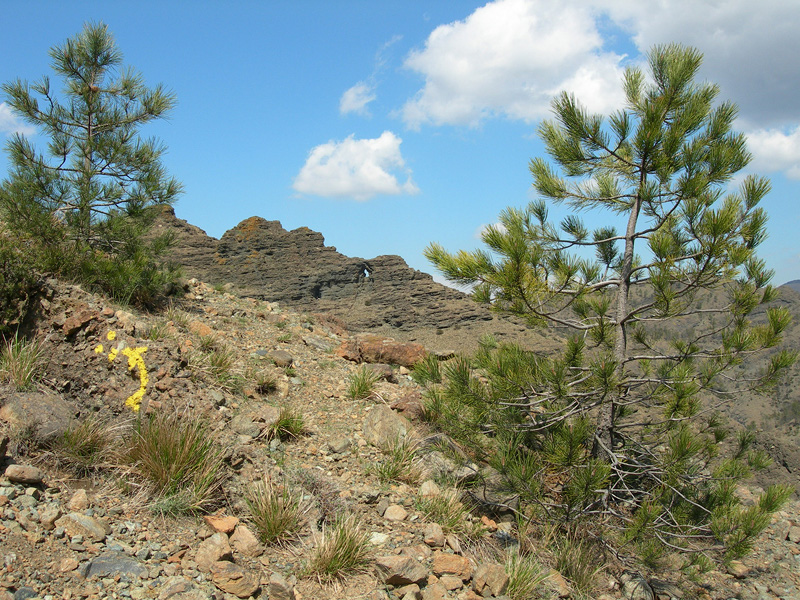
 Walking through Valle Gargassa means a plunge into an environment where the type of rocks, the water streams and the adjustments of the vegetation to the climate have ’mixed’ to create a land characterized by a high geodiversity and biodiversity, which remains uncontaminated up to the present day. In its steep walled canyons, waterfalls, ponds and hill areas, extremely different habitats have developed, even within short distance form each other. The high geodiversity value is due both to the various shapes taken by the rises, and to the different types of rocks that can be noticed while walking the “sentiero natura”, purposely set up by the Park Authority, that leaves from the sports ground in Gargassino. Strolling in these places you might trample both on ancient stones, that formed an old ocean (180 million years ago), and on relatively more recent rocks, that made up a sea, which we can imagine coming from the present Pianura Padana. It is possible to observe what was left by the ancient ocean by stopping for a moment on the
peridotites (rocks that were part of the deepest layer of the so called “lithospheric mantle”) but also to discover rocks such as the serpentine, the metabasite,”calcescisti”, also “witnesses” of the big geologic revolutions that concerned the Liguarian territory.
Many ponds and waterfalls that you will meet in the bottom of the valley have been carved by the Gargassa stream just where the serpentinite, dark green rocks, outcrops, which
confers a beautiful emerald colour to the expanses of water. Deep inside the valley,
where you come across vertical walled canyons of a dark brown colour (black rocks), the type of rock changes again: we are indeed in the middle of sedimentary formation of conglomerate and breccias that give to the landscape a particularly suggestive atmosphere.
The vegetation varies as well depending on the geological substratum: from the mixed woods which exist in the patches characterised by metamorphic rocks such as metabasites and ”calcescisti”, to thin pine forests on a Serpentinite substratum, to end up with the bare canyon walls and its conglomerates and breccias, by which only plants adapted to live in extreme conditions grow. It is a site of great geologic interest, one that also presents salient historical and cultural features. In particular we refer to the town of Vereira, where you can observe ancient signs of the men who in this remote corner of the Park had started productive activities, linked to the working of glass, to the exploitation of the wood to obtain coal.